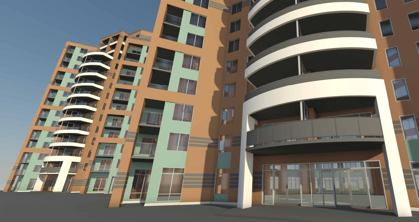
3D LiDAR SCANNING SERVICES
Capture every detail of your infrastructure with precision through our 3D scanning services.
When working with us
YOU CAN EXPECT
We transform your physical spaces into high-quality 2D and 3D digital plans. Using advanced LiDAR technology, we deliver fast, accurate site measurements and geolocatable 3D models. 3D scanning streamlines building documentation, improves team coordination, and reduces errors associated with manual measurements. Our models are fully compatible with Revit, AutoCAD, BIM, STEP, SAT, and many other formats.
PRECISION
Our laser scans deliver millimetric accuracy for technical installations, complex renovations, and plan updates. They reduce errors, prevent costly rework, and ensure a perfect match between the real site and your digital models.
FIELD TO FILE
We capture the geospatial data of your building to deliver accurate, production-ready 2D plans and 3D models compatible with DWG, Revit, CAD, STEP, SAT, and more. Our turnkey approach ensures seamless integration into your CAD/BIM software and existing workflows.
SPEED
Using advanced capture tools, we can quickly scan your entire building to produce precise, actionable 2D plans and 3D models that integrate directly into your CAD/BIM environment.
During our 3D Scanning Process
YOU CAN COUNT ON
We approach every project with a LiDAR-first methodology. Before scanning begins, our team works closely with you to define scope, precision requirements, and the intended use of the data. We then plan the LiDAR capture process in detail, optimizing scan positions, overlap, and resolution to accurately document existing conditions. This structured approach ensures reliable point cloud data that can be confidently used for modeling, analysis, and decision making.
1
Consultation and planning
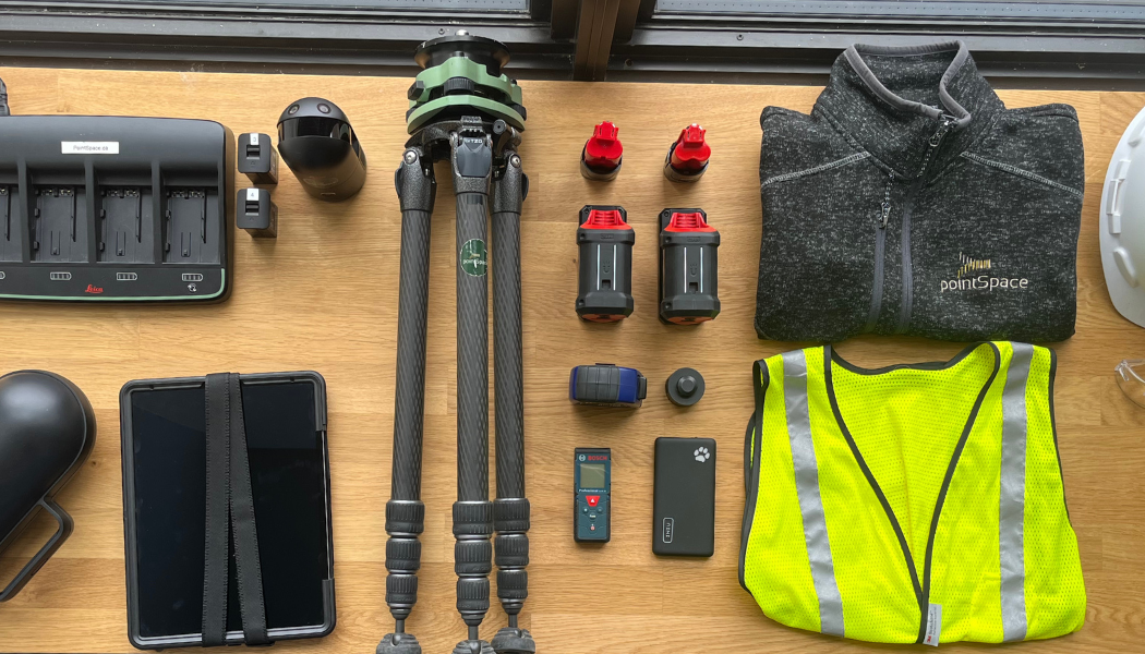
We start by learning about your objectives, timelines, and required accuracy. Based on this, we choose the optimal scanning technology and map out the scan positions and overlap needed to capture all details. Proper pre-scanning planning, including site assessment, equipment setup, target placement, and scanning positions, is critical for accurate data.
2
Thorough site preparation
Before the scanner arrives on site, our team assesses access points, environmental conditions (light, temperature, dust) and potential hazards, and ensures all equipment is calibrated and ready. We strategically place targets and control points to improve alignment.
3
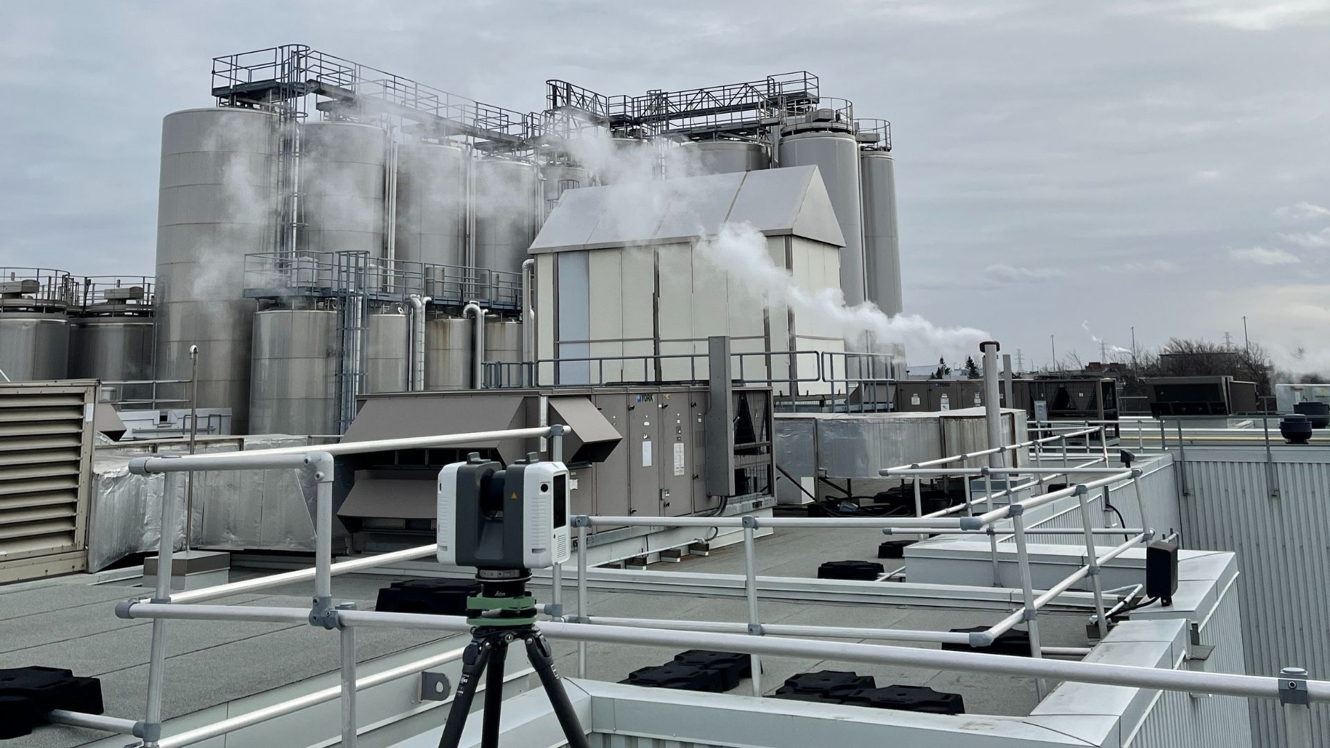
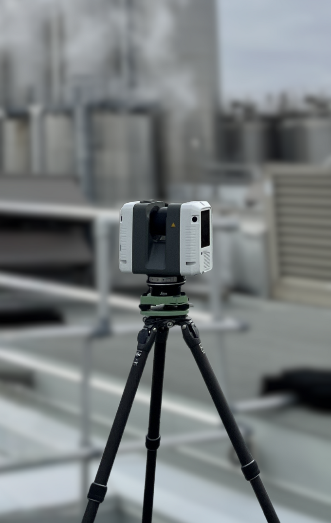
High-accuracy scanning
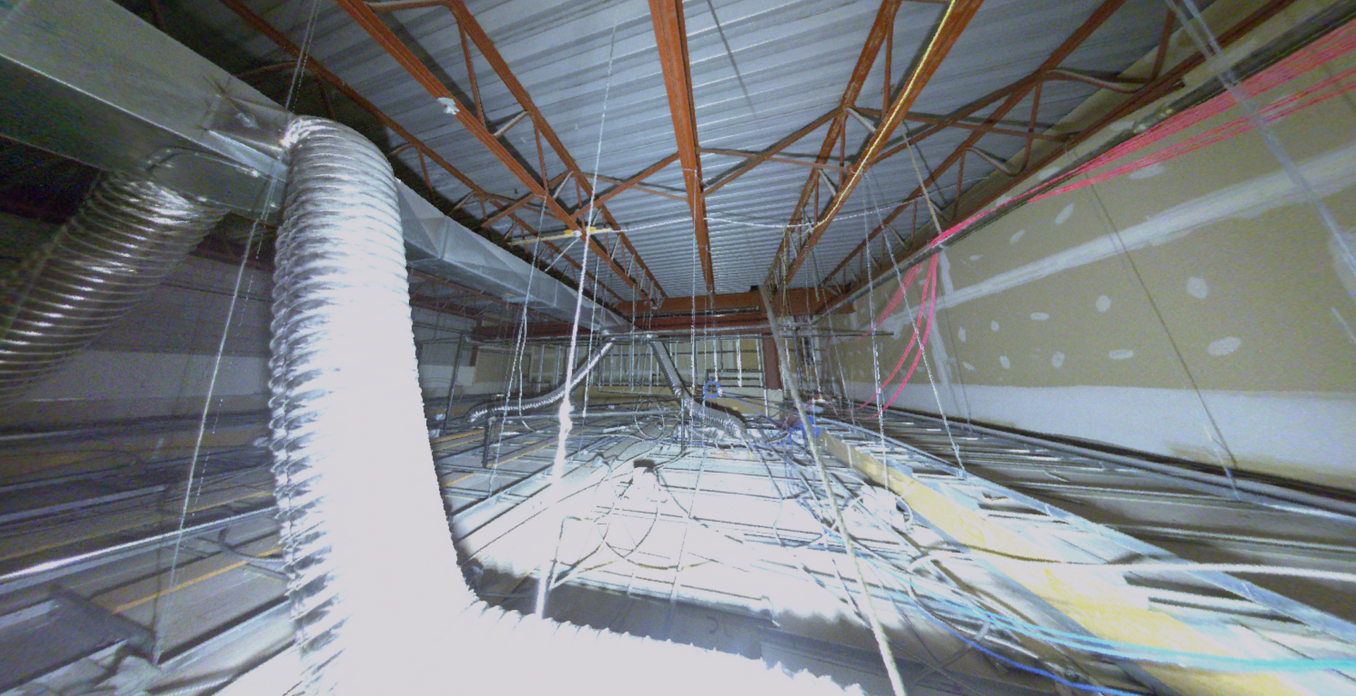
During scanning, we securely mount and position the LiDAR scanner, adjust settings to suit site conditions, and capture multiple overlapping scans. We reposition the scanner as needed and monitor progress in real time to avoid errors that could compromise point‑cloud quality. This structured approach prevents misalignment, noise artefacts and incomplete coverage.
4
Precise data processing
After LiDAR scanning, we import the raw point clouds, align multiple scans into a single coordinate system, and filter out noise or stray points. We segment the data into logical layers, extract features and verify registration accuracy against survey control points to ensure a reliable dataset for CAD/BIM modeling.
5
Detailed models and deliverables
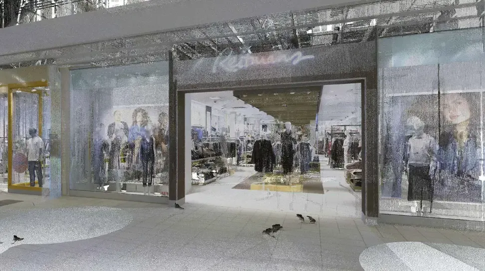
With a clean, registered point cloud, our specialists extract features and generate accurate 3D models or 2D plans. We deliver files in your preferred format (Revit, AutoCAD, STL, etc.) and ensure they are compatible with your software.
6
Quality control and support
We verify accuracy through quality control checks, including target placement, dimensional accuracy, and scanning gaps, before delivering the final dataset. Our team remains available for training and support after delivery.
Everything You Need to Know
about 3d Scanning
Explore our blog to discover articles, case studies, and practical tips on 3D scanning, modeling, and digital twins. Learn how to optimize your construction, architecture, or manufacturing projects using 3D technologies and the best practices shared by our experts.
Proven results across 400+ projects
We work with clients across a wide range of sectors, including construction, architecture, industrial and manufacturing. Our goal is to deliver practical and tailored 3D scanning solutions that provide accurate, meaningful results aligned with your project’s needs.
FAQ
Want to learn more about our 3D scanning and 3D modeling services? Our team is here to answer your questions and provide personalized guidance. Feel free to contact us to discuss your project.
What is 3D Scanning?
3D scanning captures a real object, building, or environment in three dimensions to produce accurate digital geospatial data. Using technologies such as laser scanning, photogrammetry, or LiDAR, a 3D scanner measures millions of points to reconstruct the object or space as a digital model, generating a highly detailed point cloud. This process creates a true-to-reality 3D representation.
This technology is widely used in architecture, construction, engineering, industrial and manufacturing environments, heritage preservation, and many other sectors. Its applications include creating digital twins, factory layout updates, façade reconstruction, as-built documentation, and more. The possibilities are nearly endless.
3D scanning is especially valuable in complex, crowded, or hard-to-access environments where manual measurements would be difficult or inaccurate. It is also ideal for producing virtual walkthroughs and interactive 3D models, allowing teams to navigate the space remotely, view sectional cuts, and analyze specific elements of the environment with clarity and precision.
What are the benefits of 3D scanning and why is it useful?
3D scanning offers significant advantages for businesses by providing highly accurate, millimeter-level measurements using advanced laser scanners and LiDAR sensors. Compared to traditional surveying methods, it is much faster, more reliable, and far less prone to human error, which helps save both time and money.
A complete site survey can be captured in just a few hours or days, depending on the size of the area, while conventional methods can take several days or even weeks. This level of efficiency reduces the risk of mistakes, minimizes costly rework, and ensures consistent data quality.
By converting existing conditions into precise digital data, 3D scanning simplifies design workflows, supports BIM integration, improves predictive maintenance, streamlines facility management, and enhances planning accuracy. It provides accessible digital models that accelerate design cycles, reduce project costs, and help teams visualize a building or environment before starting any work.
3D scanning is especially effective in complex, congested, or hard-to-access environments where manual measurements are difficult. It is also ideal for creating virtual walkthroughs and interactive 3D models, allowing stakeholders to remotely navigate the space, view sectional cuts, and analyze specific elements with greater clarity.
How long does 3D scanning take?
The duration of a 3D scan depends primarily on the size of the space and the complexity of the environment. Scanning a single room can take anywhere from a few minutes to a few hours, while a larger building may require several hours or multiple days.
Beyond the scanning phase, post-processing also adds to the total project time. This includes alignment, cleaning, and merging of the individual scans. In practice, the full timeline includes both the onsite data capture and the software processing that follows. Desired resolution, scan density, obstacles and lighting, and overall site conditions can also affect the final duration.
For more information about our 3D scanning and 3D modeling process, you can explore the following articles:
How does 3D laser scanning work?
Our 3D data capture process typically involves several key steps. First, we select the most suitable tool for the project. The site is then scanned from multiple angles to cover its entire surface and generate a point cloud. These raw data are processed using specialized software for alignment, cleaning, and merging, resulting in 3D models, detailed plans, or building analyses.
The final outputs can include 3D models, BIM (Building Information Modeling) models with detailed component data, architectural or technical plans, and building analyses such as BOMA measurements, flatness and verticality studies, or structural deformation assessments. All outputs are based on our precise surveys, providing a reliable foundation for planning, maintenance, and renovations.
Our laser scanners provide real-time visual feedback during capture, allowing us to verify that every area has been fully documented. In simple terms, we capture the environment in 3D the same way a camera captures photographs and then process the data to rebuild an accurate digital version of the existing conditions.
For more information about our 3D scanning and modeling process, you can explore these articles:
Which industries do you serve?
We primarily support the building and manufacturing sectors, with a strong focus on construction, engineering, and architecture. Our solutions apply to a wide range of use cases, including plant reconfiguration, asset management, asset sales, as-built documentation, progress tracking, building analysis, heritage preservation, and much more.
Our services include 3D modeling, building analysis, BOMA floor plans, progress reporting, virtual tours, 360° photos, digital twins, BIM, and architectural renderings. With this comprehensive approach, we enable our clients to visualize, plan, and manage their buildings and equipment with accuracy, efficiency, and confidence.
Which deliverable formats do you offer, and do you provide training?
How can I get a quote for a 3D scanning project?
Simply fill out this form: Request a Quote, specifying your needs, the services you are looking for, and the details of your project. Our team will be happy to contact you, answer your questions, clarify your requirements, and provide a detailed quote quickly, perfectly tailored to your 3D scanning project.
"The pointSpace team provided a high-quality, fast and efficient service to meet our operational needs.
The plans produced by pointSpace help both our customers and our coordination team prepare for outstanding events at Théâtre St-James."
- Juliano Rodriguez-Daoust,
VP Business Development and Acquisitions
Carosielli Group