3D MODELING SERVICES
Get ready-to-use 3D models you can seamlessly integrate into your favorite software (Revit, Inventor, CAD, STEP, SAT, and more.)
When working with us
YOU CAN EXPECT
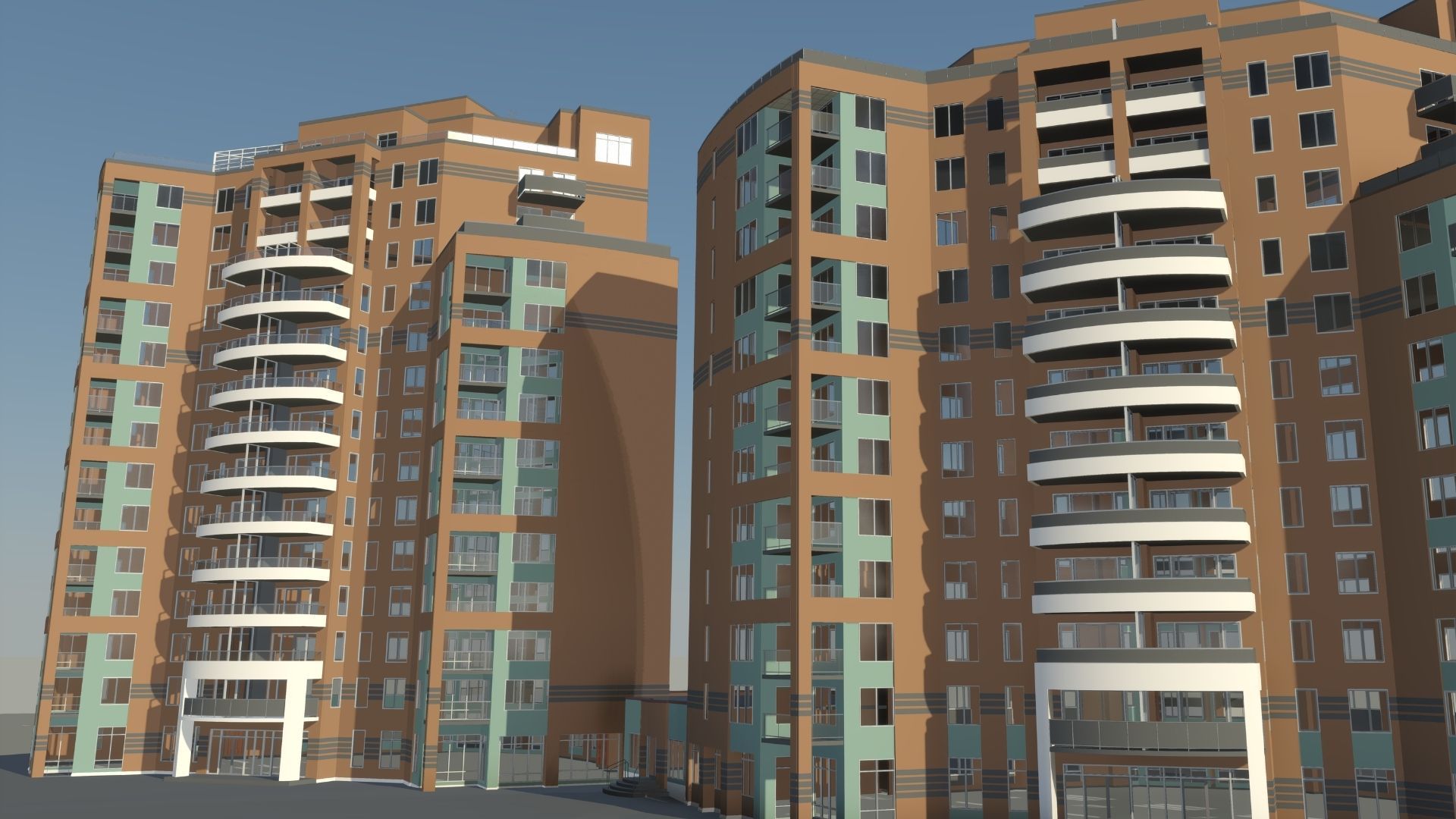
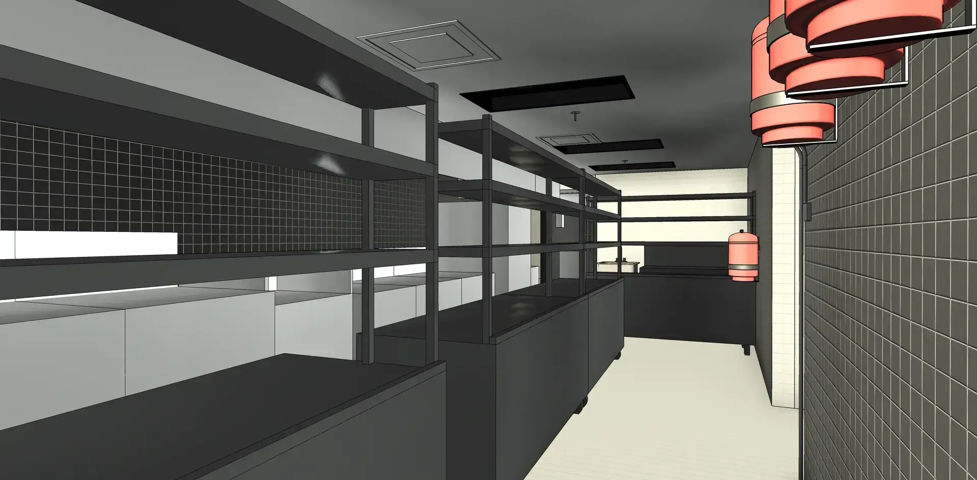
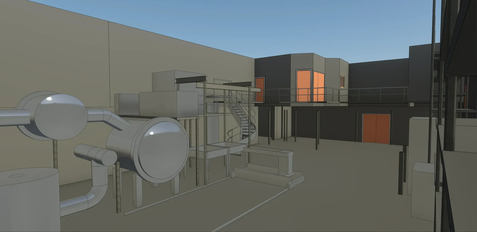
We provide professional 3D modeling services that transform your physical spaces into accurate 3D models. Leveraging high-resolution LiDAR scanning and our 3D modeling expertise, we capture every detail to produce precise as-built plans and 3D models.
PRECISION
Our 3D modeling services start with detailed on-site data capture, documenting every dimension and feature of your building or equipment. This precise foundation enables highly accurate as-built plans and 3D models that reflect real-world conditions, reducing errors during design, renovation, or construction.
FIELD TO FILE
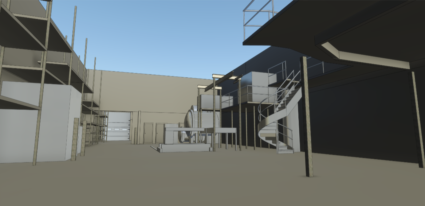
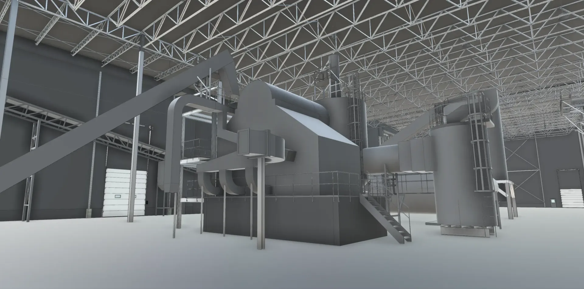
We capture and convert spatial data into clean, structured 3D models. Our services include CAD drawings, Revit models, and 3D formats like DWG, IFC, STEP, and SAT, with properly named layers and organized files for smooth integration into your projects.
EFFICIENCY
Our high-quality 3D models eliminate repetitive site visits and manual measurements. They help your team plan confidently, catch issues early, and collaborate efficiently, reducing delays, improving communication, and allowing you to focus on what truly matters.
During our 3D Modeling Process
YOU CAN COUNT ON
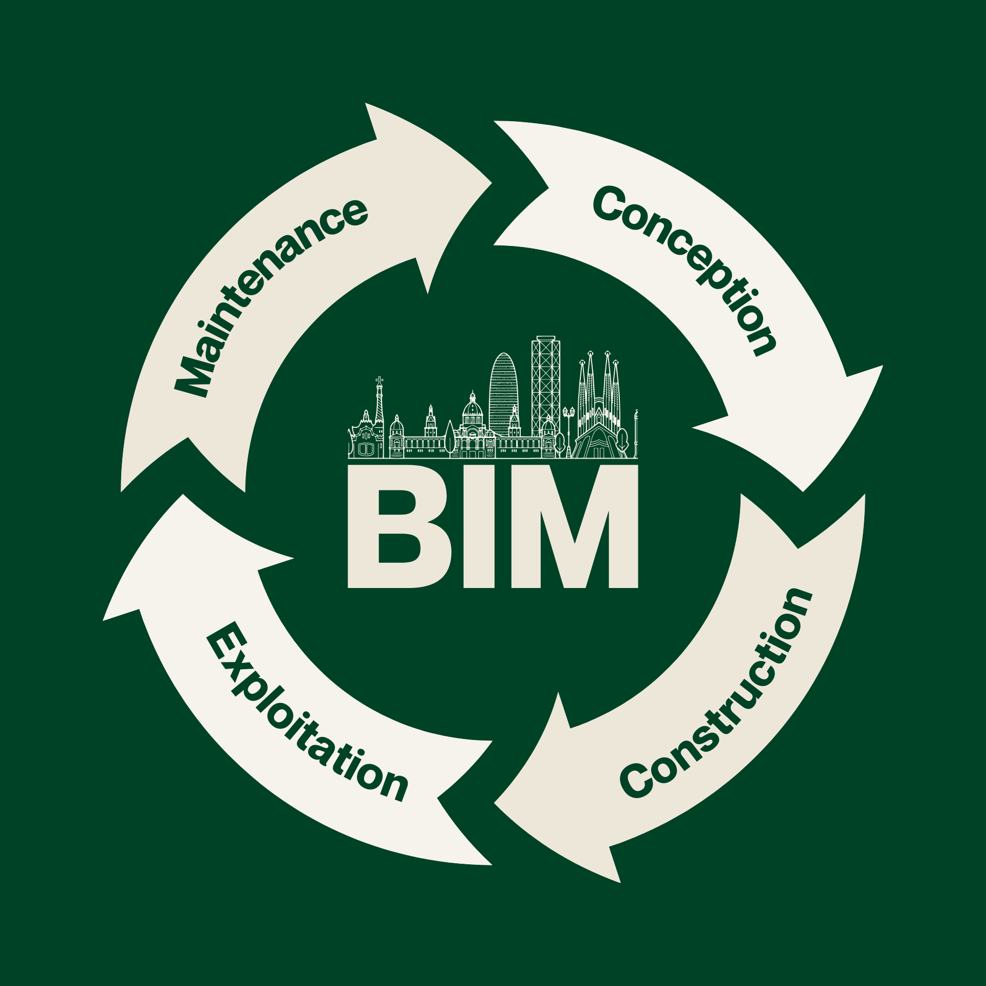
Our 3D modeling services are built on accurate reality-capture data and a structured modeling workflow. By transforming point clouds into precise digital models, we deliver reliable representations of existing conditions that support design, analysis, and decision-making across a wide range of projects.
1
Defined modeling objectives
We begin by understanding how the 3D model will be used, whether for design coordination, technical analysis, visualization, documentation, or downstream BIM workflows. At this stage, we define the required Level of Detail, modeling scope, tolerances, and output formats to ensure the model aligns with project requirements from the outset.
2
Accurate source data
All 3D models are developed from high-quality point clouds generated through 3D scanning. This ensures the modeled geometry reflects real-world conditions, providing a dependable foundation for accurate measurements, spatial analysis, and coordination.
3
Unified and clean point clouds
Before modeling begins, point-cloud data is registered, aligned, and processed to remove noise, redundant points, and irrelevant elements. The dataset is structured and optimized to support efficient modeling while preserving the accuracy required for technical use.
4
Consistent 3D modeling
Using specialized modeling software, we convert point-cloud data into accurate digital models and drawings tailored to your workflow. This includes CAD drawings, Revit models, and 3D formats such as DWG, IFC, STEP, and SAT. All files are delivered with properly named layers, organized model structures, and consistent conventions to ensure seamless integration into design, coordination, and analysis workflows.
5
Quality control validation
Each model undergoes a quality-control review against the original point cloud to verify dimensional accuracy, alignment, and completeness. This validation process ensures the final model remains a faithful digital representation of existing conditions.
6
Usable deliverables and support
Final 3D models are delivered in formats compatible with your workflow, including Revit, AutoCAD, and other industry-standard platforms. Our team remains available to support revisions, coordination, and future project phases as needs evolve.
Everything You Need to Know
about 3d MODELING
Explore our blog to discover articles, case studies, and practical tips on 3D scanning, 3D modeling, and digital twins. Learn how to optimize your construction, architecture, or manufacturing projects using 3D technologies and the best practices shared by our experts.
Proven results across 400+ projects
We collaborate with clients across various industries, including construction, architecture, industrial, and manufacturing. Our goal is always to deliver practical, tailored 3D modeling services that align with your needs. By providing accurate digital models, we help teams plan projects, detect issues early, and streamline workflows, ensuring every project runs smoothly from start to finish.
FAQ
Want to learn more about our 3D scanning and 3D modeling services? Our team is here to answer your questions and provide personalized guidance. Feel free to contact us to discuss your project.
What is 3D modeling?
3D modeling is the process of creating a digital, three-dimensional representation of a physical object, space, or structure. It allows you to visualize, analyze, and interact with a project before any physical work begins. Using advanced LiDAR scanning, photogrammetry, and precision measurement tools, we capture every dimension and detail of your building, equipment, or industrial facility.
Our 3D modeling services provide highly accurate digital models that can be used for a wide range of applications:
- Design and Renovation: Plan modifications with precision and reduce errors during construction.
- Construction Planning and Coordination: Use the models to detect clashes, organize tasks, and coordinate teams efficiently.
- Asset Management: Maintain a digital record of equipment, infrastructure, and building layouts for future maintenance or upgrades.
- Facility Layouts and Industrial Planning: Optimize workflows, machinery placement, and safety planning in factories or industrial spaces.
- Virtual Tours and Visualization: Generate realistic walkthroughs or presentations for stakeholders, clients, or project approvals.
These models are compatible with industry-standard software such as Revit, AutoCAD, STEP, SAT, and more. They are fully editable, geolocated, and structured with organized layers, naming conventions, and clear documentation.
By providing precise, reliable 3D models, we help teams reduce site visits, detect potential issues early, improve collaboration across disciplines, and make confident, data-driven decisions throughout the project.
Which deliverable formats do you offer, and do you provide training?
We deliver your plans and 3D models in the format of your choice, including DWG, Revit, CAD, STEP, SAT, and more. Personalized training is also available to help you use your new plans or models effectively and get the most out of your digital files.
What industries do you provide 3D modeling services for?
We provide 3D modeling services to clients across construction, architecture, industrial, manufacturing, and commercial sectors. Our services are tailored to each project, whether it’s a building renovation, factory layout, retail space, or complex industrial facility, ensuring accurate and usable digital models for every application.
What types of 3D modeling services do you offer?
We provide high-resolution 3D scans, point cloud models, detailed 2D drawings, 3D Revit models, CAD drawings, and 3D models in multiple file formats, including DWG, IFC, STEP, and SAT. Each model is carefully organized, labeled, and geolocated to ensure seamless integration into your workflow.
How accurate are your 3D models?
We use millimeter-level LiDAR scanners to capture precise measurements, ensuring our 3D models are highly accurate. While absolute millimetric precision cannot be guaranteed, our models consistently deliver a very high level of accuracy, making them ideal for design, planning, and construction applications.
Can your 3D models be used across different software platforms?
Yes. While models are not automatically compatible with every platform, we create them in the file formats you need. Our 3D modeling services are tailored to your requirements, and we deliver models in your preferred formats, such as Revit, AutoCAD, STEP, SAT, and more. Each file is carefully prepared for smooth integration into your workflows without additional setup.
How do 3D models benefit my project?
Accurate 3D models reduce the need for repetitive site visits, improve team collaboration, streamline planning, and support better decision-making. They allow you to visualize spaces, optimize layouts, detect potential conflicts, and coordinate construction or renovation projects efficiently.
"PointSpace's work has enabled us to demystify the current state of a building that, since its construction in 1960, has undergone several undocumented interventions. The detailed layout provided by the team will save us many unforeseen problems during the construction phase. "
- Jacob Marquis,
Real Estate Development Coordinator
Broccolini