AS-BUILT DRAFTING SERVICES
Get detailed, ready-to-use as-built digital plans of your site or building so you can focus on what matters most.
When working with us
YOU CAN EXPECT
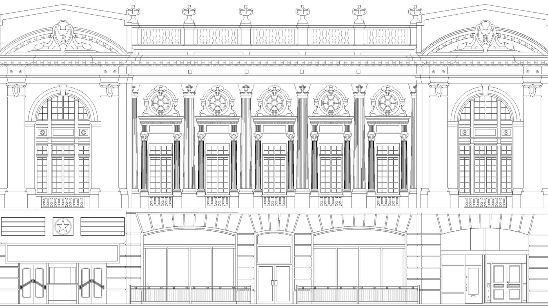
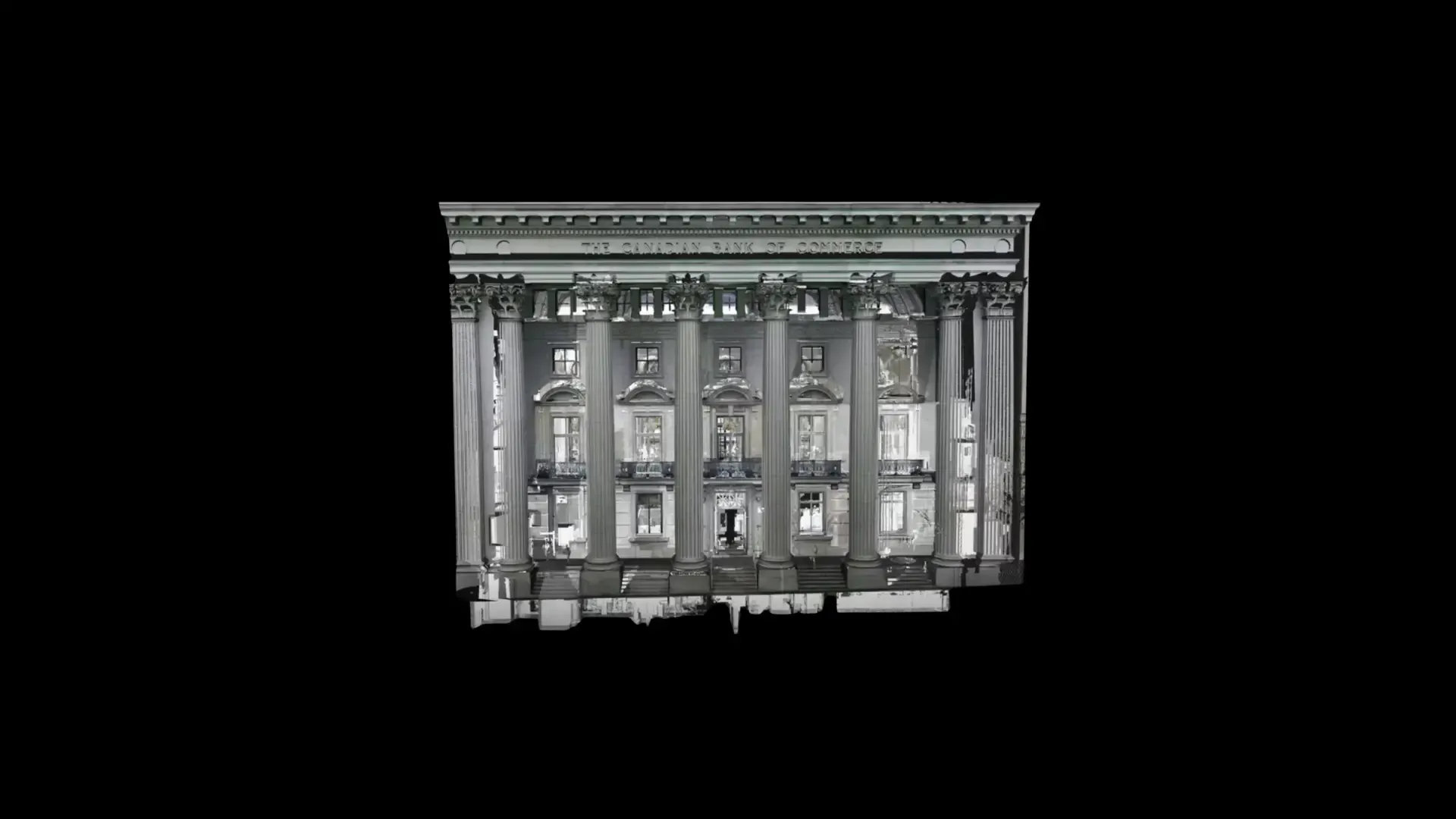
We transform physical spaces into high-quality as-built digital plans and floor plans. Using advanced LiDAR scanning technology alongside our expertise in as-built drafting and modeling, we deliver fast, accurate surveys, precise plans, and geolocatable 3D models.
PRECISION
We prioritize precision.
By leveraging millimeter-precision scanners and our expertise in as-built drafting and modeling, we deliver high-quality 2D plans and floor plans.
By combining advanced tools with meticulous attention to detail, we give our clients the confidence to start every project with reliable and precise plans.
FIELD TO FILE
From data capture to as-built drafting, we provide end-to-end tailored solutions. We capture spatial data and deliver ready-to-use as-built digital plans and floor plans in your preferred formats. Whether you need detailed architectural drawings or as-built surveys, we efficiently turn field measurements into precise, easy-to-use digital files.
EFFICIENCY
With our as-built drafting services, you can focus on high-value tasks instead of spending time on manual measurements and drafting. Our team quickly converts on-site data into precise, detailed digital plans, allowing you to save time, avoid errors, prevent costly rework, and speed up the decision-making process.
Proven results across 400+ projects
We collaborate on a wide range of projects for clients in construction, architecture, engineering, and manufacturing. Our mission is to provide high-quality as-built drafting services, from precise on-site data capture to the creation of accurate as-built plans and floor plans.


MOST FREQUENT
QUESTIONS
Want to learn more about our 3D scanning, 3D modeling and as-built drafting services? Our team is here to answer your questions and provide personalized guidance. Feel free to contact us to discuss your project.
What level of accuracy can I expect from a professional 2D plan?
Our 2D plans are created from high-precision LiDAR data captured with millimeter-grade scanners, giving us an extremely accurate foundation to work from. While we do not provide a guaranteed tolerance level, our workflows, tools, and quality checks allow us to consistently produce highly precise and reliable plans suitable for architectural, engineering, and construction projects.
In which digital formats can you deliver my 2D plans or floor plans?
We can deliver your 2D plans or floor plans in the formats you prefer, such as DWG, DXF, PDF, and more. Depending on your needs, we adapt both the file format and the level of detail to ensure your plans integrate seamlessly into your workflow.
Can I edit the 2D plan or request changes after delivery?
Yes. Editable file formats such as DWG or DXF can be opened and modified in software like AutoCAD, Revit, or other CAD tools. You can make your own adjustments, annotations, or updates as needed. If you prefer, we can also apply revisions or updates to the plans upon request.
"pointSpace's work has enabled us to demystify the current state of a building that, since its construction in 1960, has undergone several undocumented interventions. The detailed layout provided by the team will save us many unforeseen problems during the construction phase. "
- Jacob Marquis,
Real Estate Development Coordinator
Broccolini