3D LiDAR Scanning &
3D Modeling Services
IN QUÉBEC AND IN ONTARIO
We capture and transform your spaces into precise 3D models. PointSpace delivers end-to-end 3D LiDAR scanning and modeling services for architecture, construction, and industry. We provide accurate data and tailored deliverables from scan to BIM, CAD, Revit, STEP, SAT, and more.
We completed over
400 PROJECTS
Since 2018, pointSpace has supported architects, engineers, and builders across Québec and Ontario with quality deliverables that combine precision and reliability. Our 3D scanning and modeling services cover everything from scan to BIM, CAD, Revit, STEP, SAT, and more.
400+
Completed projects
50+
Satisfied customers
∞
Possibilities
Comprehensive 3D Solutions
TAILORED TO YOUR NEEDS
3D LiDAR SCANNING
Fast and precise 3D LiDAR data capture for infrastructure, facades, mechanic, ceilings and roofing.
BUILDING ANALYSIS
Structural and facade analysis for deformation, flatness, verticality, and heritage preservation.
BOMA As-Built Digital Plans
Standardized BOMA measurements for accurate area calculations. Ideal for property managers, landlords, and owners.
PROGRESS REPORTING
Accurate surveys and as-built 3D scans, plans, and models providing precise data for project tracking and quality assessment.
AS-BUILT DRAFTING
Accurate as-built 2D and 3D plans created from detailed 3D scans. From basic layouts to highly detailed plans of structures, facades, mechanical systems, roofing, and more.
360° PHOTO
Precise, high-resolution 360° site photography that can be converted into immersive and interactive Matterport virtual tours.
MATTERPORT VIRTUAL TOURS
Immersive and secure 3D Matterport virtual tours. Perfect for marketing initiatives, presentations, and remote project access.
Start your next project with PointSpace.
Our Achivements
With more than 400 completed projects across Québec and Canada, pointSpace offers professional 3D scanning (Scan to BIM, Revit, CAD, and more), 3D modeling, and building analysis services for architectural, construction, and industrial projects.
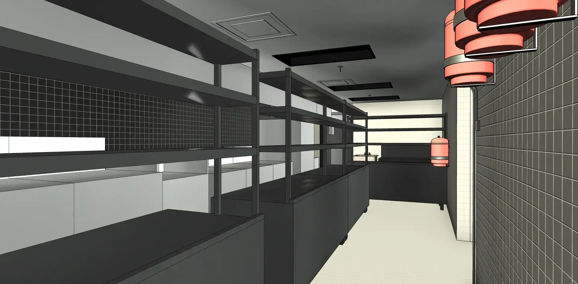
Comprehensive Building 3D Scanning & 3D Modeling
View case studyMost frequent questions
Learn more about our 3D LiDAR scanning and modeling services, from data accuracy to deliverables. If you still have questions, don’t hesitate to contact our team. We’re here to help.
What types of services and deliverables do you offer?
We provide complete 3D LiDAR scanning and modeling services for buildings, infrastructure, and industrial facilities across Quebec and Ontario. From on-site data capture to modeling, we handle every stage up to the delivery of the final product.
Deliverables are tailored to your needs, projects, and workflows, ranging from point clouds to detailed 2D plans and 3D models. We deliver the final result in your preferred formats, such as Revit, CAD, STEP, SAT, and more.
What level of accuracy do you achieve with LiDAR scanning?
We use laser sensors equipped with LiDAR technology, providing millimeter-level accuracy and ensuring high-quality, precise, and reliable deliverables.
Which regions do you serve?
We offer our services throughout Quebec and Ontario. Data capture is performed on-site, while our team remotely manages drafting, modeling, and data processing. Deliverables are securely provided in your preferred formats, such as Revit, CAD, STEP, SAT, and more.
"A high-quality, fast, and efficient service."
- Juliano Rodriguez-Daoust,
VP Business Development and Acquisitions,
Carosielli Group
"The service was A1, we made several changes and these were always made quickly."
-Olivier Tremblay,
Process Improvement and Maintenance Manager,
Nelmar