

Prevost
3D Scanning a bus factory
Setting the scene
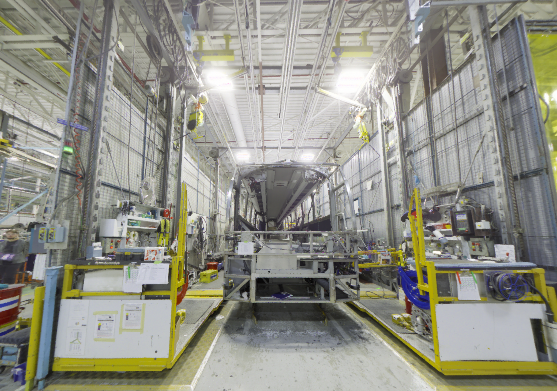
Prévost, a bus manufacturing company that is part of the Volvo Group, partnered with pointSpace to support the management, understanding, and control of its geospatial data within its facilities.
The mandate aimed to accurately document the existing conditions of specific targeted areas in order to provide a reliable information base for site analysis, future intervention planning, and technical decision-making.
Using 3D scanning technology, pointSpace captured the structural and technical elements present on site, including the building’s main components as well as specific equipment. This documentation provided an accurate representation of the existing environment and facilitated a better understanding of the spaces and associated constraints.
Proposed solutions
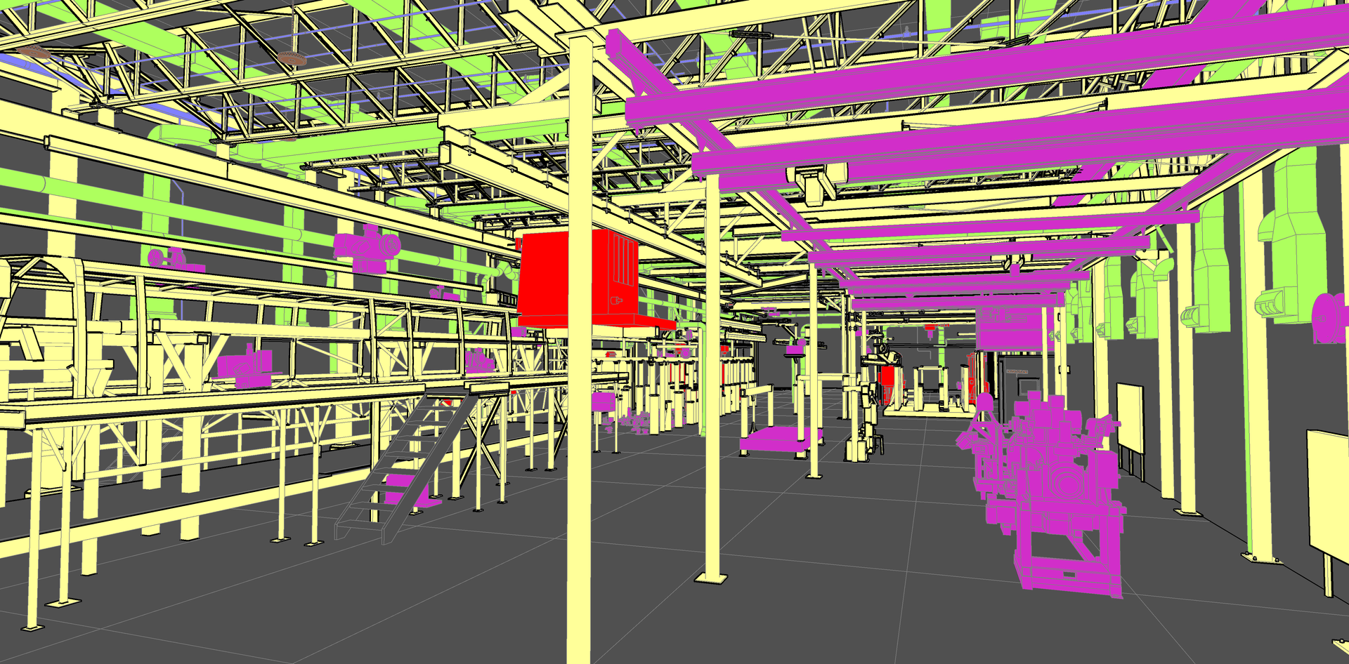
To meet the project requirements, pointSpace carried out an indoor 3D scan of the areas covered by the mandate. Certain key zones were captured in color to improve the visual understanding of existing conditions and support site analysis.
The deliverables included the point cloud data, giving Prévost’s team access to an accurate and usable representation of the scanned environment.
In addition, pointSpace also produced STP modeling files integrating the main visible elements required for the technical understanding of the targeted areas, including:
- openings;
- partitions;
- main beams;
- ceilings;
- mezzanines;
- ventilation systems;
- lighting;
- floor markings;
- machinery and equipment present in the surveyed areas.
This documentation provided a clear and structured foundation to support the understanding of existing conditions, technical coordination, and the planning of subsequent project phases.
Gains
Thanks to pointSpace’s involvement, Prévost was able to:
Access accurate existing-condition data
The 3D scanning and detailed documentation of the targeted areas provided a reliable representation of the real environment, including structural, architectural, and technical elements, as well as certain equipment and machinery present on site.
Improve understanding of the facility layout
With a clear overview of openings, partitions, structural elements, ceilings, mezzanines, ventilation systems, lighting, and floor markings, the project team gained a better understanding of the spatial organization of the surveyed areas.
Support planning and coordination efforts
The generated data, including the point cloud and modeling files, provided a reliable visual and technical foundation to facilitate the planning of future work and the coordination of interventions within the facilities.
Work with precise positioning of key equipment
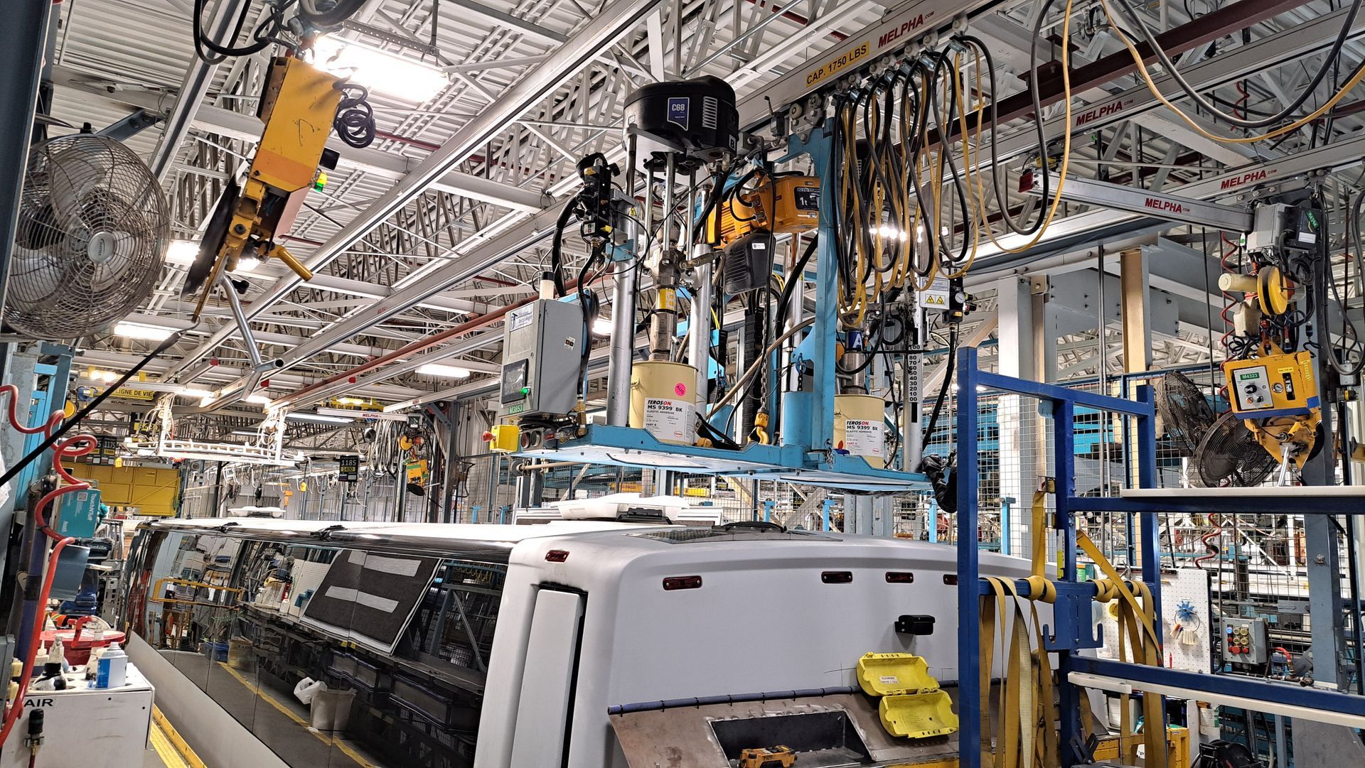
The integration of machinery and major equipment, such as cranes, gantries, and fastening devices, made it possible to better account for spatial constraints, required clearances, and potential interactions between the different elements of the existing environment.
“Excellent scan and modeling quality. We had two sectors of the plant scanned, which allowed us to accurately validate measurements and visualize workspace congestion before making physical modifications.
Louis, Maxime, and Thomas are attentive and know how to respond to our needs. Excellent service!”
- Ulric Roy-Pelletier
Mechanical processes technician
Prevost
Why
pointSpace ?
Our mission is simple: to bring the building directly to our customers' computers. With accurate data and intuitive access, we enable our partners like Reitmans to gain time, efficiency and control over their projects.

Article by
Louis Dallaire
A graduate of ÉTS in operations and logistics engineering, Louis is passionate about the industrial world. His goal with pointSpace is to make data management and use accessible, because it's not always necessary to use complex tools to solve simple problems !
Comprehensive Building 3D Scanning & 3D Modeling
View case studyContact Us
We will get back to you as soon as possible.
Please try again later.
